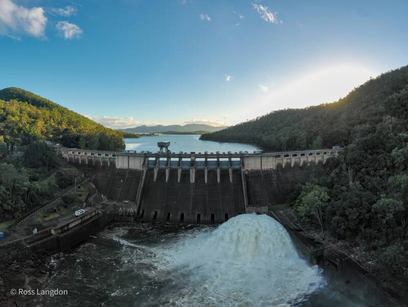
South East Queensland Dams, Lakes & Waterways Destination Guide
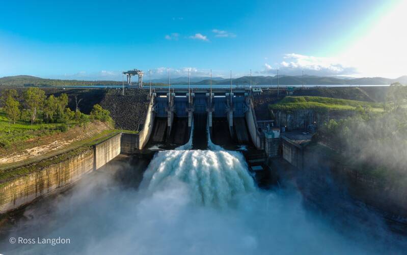
Aerial Photography of Brisbane Reservoirs, Scenic Rim Lakes & Queensland Water Landscapes
Discover South East Queensland's Water Landscapes From Above
South East Queensland is home to a remarkable collection of reservoirs, lakes, rivers and waterways that shape the region's natural environment and communities.
From vast inland reservoirs surrounded by mountains to hidden forest lakes on Brisbane's western edge, these waterways reveal a constantly changing landscape influenced by rainfall, seasons and weather.
From above, SEQ's waterways showcase:
- expansive reservoirs
- winding river systems
- forest-covered catchments
- mountain reflections
- islands and peninsulas
- rural landscapes
- dramatic seasonal changes
Oz Straya Panoramas captures these landscapes through professional aerial photography, revealing the scale, patterns and beauty of Queensland's waterways.
This guide explores:
- Lake Wivenhoe
- Somerset Dam
- Hinze Dam
- North Pine Dam
- Lake Manchester
- Gold Creek Dam
- Enoggera Reservoir
- Lake Moogerah
- Lake Maroon
- Baroon Pocket Dam
- Borumba Dam
- Leslie Harrison Dam
- Brisbane River waterways
- Gold Coast waterways
Why South East Queensland Waterways Make Exceptional Aerial Photography
Water landscapes create some of the most visually dynamic aerial photography opportunities in Queensland.
Reservoirs constantly change with:
- rainfall
- water levels
- reflections
- cloud conditions
- seasonal vegetation
- sunlight
Aerial photography reveals details invisible from ground level:
- submerged valleys
- shoreline patterns
- river channels
- forest boundaries
- connections between mountains and waterways
These landscapes are ideal for:
- landscape artwork
- tourism promotion
- editorial use
- commercial licensing
- regional storytelling
Lake Wivenhoe
Queensland's Largest Inland Water Landscape
Lake Wivenhoe is one of South East Queensland's most significant reservoirs.
Located along the Brisbane River catchment, the lake provides water security and flood mitigation benefits for the region.
The landscape features:
- large open water areas
- forested hills
- winding bays
- rural surroundings
- Brisbane River connections
From above, Lake Wivenhoe reveals the enormous scale of the catchment and the relationship between water, farmland and surrounding mountain ranges.
Photography Highlights
Best conditions:
- sunrise reflections
- morning mist
- calm water
- dramatic summer skies
Somerset Dam & Lake Somerset
Mountain Valleys and Inland Waterways
Lake Somerset is one of Queensland's most scenic inland reservoirs.
Surrounded by hills, forests and rural landscapes, it provides outstanding aerial photography opportunities.
Key features include:
- winding shorelines
- sheltered bays
- mountain backdrops
- changing water patterns
The combination of water and surrounding countryside creates a strong visual connection between natural and agricultural landscapes.
Hinze Dam
Gold Coast Hinterland Water Landscape
Hinze Dam is one of the most scenic reservoirs in the Gold Coast Hinterland.
Surrounded by forested mountains, the reservoir demonstrates the close connection between water storage and the region's rainforest landscapes.
Aerial photography highlights:
- winding waterways
- forest-covered valleys
- mountain reflections
- shoreline patterns
Hinze Dam is particularly impressive when combined with nearby Gold Coast Hinterland landscapes.
North Pine Dam
Brisbane's Northern Reservoir Landscape
North Pine Dam, also known as Lake Samsonvale, provides an important water landscape north of Brisbane.
From above, the reservoir reveals:
- sheltered bays
- forested shorelines
- changing water levels
- surrounding bushland
The lake provides a contrast between Brisbane's urban environment and surrounding natural landscapes.
Brisbane Western Reservoirs
Lake Manchester, Gold Creek Dam & Enoggera Reservoir
Hidden Water Landscapes on Brisbane's Mountain Edge
Western Brisbane contains some of the city's most scenic and historic reservoirs.
Lake Manchester, Gold Creek Dam and Enoggera Reservoir sit among bushland, forested valleys and the foothills of the D'Aguilar Range.
These waterways provide a unique combination of:
- natural landscapes
- historic engineering
- forest catchments
- mountain scenery
From above, they reveal how Brisbane's water infrastructure follows the natural shape of the landscape.
Lake Manchester
A Quiet Forest Reservoir West of Brisbane
Lake Manchester is a peaceful reservoir surrounded by native bushland and forested hills.
Located approximately 25 kilometres west of Brisbane, the reservoir forms part of the SEQ water network and was originally constructed in 1916.
From above, Lake Manchester showcases:
- winding shoreline formations
- secluded bays
- forest-covered ridges
- narrow water channels
- untouched bushland
The contrast between the dark water and surrounding eucalyptus forest creates striking aerial compositions.
Best Photography Conditions
Lake Manchester is ideal during:
- early morning mist
- winter sunrise
- calm weather
- post-rainfall conditions
Gold Creek Dam
Brisbane's Historic Mountain Reservoir
Gold Creek Dam is one of Brisbane's most significant historic water landscapes.
Constructed in 1885, the dam was originally built to supplement Enoggera Dam. The two reservoirs are connected within Brisbane's western catchment system.
Surrounded by forest and steep valleys, Gold Creek Dam provides a unique aerial subject.
Photography highlights include:
- historic dam wall
- forest catchments
- reservoir patterns
- mountain scenery
The location is especially impressive after rainfall when the surrounding vegetation becomes vibrant green.
Enoggera Reservoir
Brisbane's Gateway to the D'Aguilar Range
Enoggera Reservoir is one of Brisbane's most recognisable inland water landscapes.
Built in 1866, it is one of Brisbane's oldest reservoirs and remains an important natural and recreational landscape near the western suburbs.
From above, Enoggera Reservoir reveals:
- broad water expanses
- forested shorelines
- sheltered coves
- mountain backdrops
The reservoir creates a natural transition between Brisbane's urban environment and the surrounding mountain ranges.
Photography Highlights
Best conditions:
- sunrise reflections
- winter mornings
- misty weather
- calm water
Lake Moogerah
Scenic Rim Mountains Reflected in Water
Lake Moogerah is one of Queensland's most photogenic mountain reservoirs.
Located within the Scenic Rim, the lake sits beneath dramatic mountain landscapes.
Aerial photography captures:
- mountain reflections
- islands
- curved shorelines
- rural landscapes
This location connects strongly with your Scenic Rim destination guide.
Lake Maroon
A Peaceful Scenic Rim Waterway
Lake Maroon combines:
- calm water
- mountain views
- forest edges
- rural landscapes
From above, the lake reveals beautiful patterns where water meets surrounding countryside.
Baroon Pocket Dam
Sunshine Coast Hinterland Lake Landscape
Located near Maleny and Montville, Baroon Pocket Dam combines rainforest, mountains and waterways.
Aerial photography highlights:
- rainforest-covered hills
- winding shoreline
- hinterland scenery
- mountain environments
Borumba Dam
Island Landscapes and Mountain Waterways
Borumba Dam near Imbil provides some of Queensland's most dramatic inland water scenery.
From above, the reservoir reveals:
- island formations
- forested shorelines
- winding channels
- mountain backdrops
Brisbane River Waterways
The Lifeline of South East Queensland
The Brisbane River connects many of the region's major landscapes.
From inland catchments through Brisbane City and towards Moreton Bay, the river creates diverse aerial photography opportunities.
Images capture:
- river bends
- bridges
- wetlands
- urban waterways
- natural corridors
Best Photography Conditions
Sunrise
Ideal for:
- reflections
- mist
- soft colours
- calm water
Sunset
Creates:
- warm tones
- mountain silhouettes
- dramatic shadows
After Rainfall
Produces:
- greener landscapes
- fuller waterways
- atmospheric conditions
Winter
Provides:
- clearer visibility
- crisp mountain views
Commercial Aerial Photography & Licensing
SEQ water landscape images are suitable for:
- tourism campaigns
- environmental projects
- editorial publications
- accommodation marketing
- corporate displays
- landscape artwork
Professional aerial photography provides a unique perspective of Queensland's waterways.
Frequently Asked Questions
What are the best dams for aerial photography in South East Queensland?
Popular locations include Lake Wivenhoe, Somerset Dam, Hinze Dam, Lake Moogerah, Lake Manchester, Gold Creek Dam and Enoggera Reservoir.
Which Brisbane dams are best for photography?
Lake Manchester, Gold Creek Dam and Enoggera Reservoir provide excellent combinations of forest, water and mountain scenery.
When is the best time to photograph Queensland lakes?
Sunrise, sunset, winter mornings and post-rainfall conditions usually provide the most dramatic results.
Can SEQ dam aerial images be purchased?
Yes. High-resolution digital images and commercial licences are available through Oz Straya Panoramas.
Explore More Queensland Landscapes
Continue exploring:
- Scenic Rim Mountains
- Brisbane City & Brisbane River
- Gold Coast Hinterland
- Lamington National Park
- Springbrook National Park
- Moreton Bay Coastal Landscapes
Experience South East Queensland's Waterways From Above
From Brisbane's historic western reservoirs to vast mountain lakes and scenic inland waterways, South East Queensland's water landscapes reveal the connection between nature, communities and the environment.
Through aerial photography, these waterways become more than reservoirs — they become a visual story of Queensland's landscapes from above.