
Noosa, Bribie Island & Sunshine Coast Destination Guide

From Bribie Island to Noosa Heads
Discover Queensland's Iconic Coastline from Above
Sunshine Coast Aerial Photography Guide | Bribie Island, Caloundra, Noosa & Coastal Landscapes
Explore Queensland's Sunshine Coast coastline through award-winning aerial photography. Discover Bribie Island, Caloundra, Point Cartwright and Noosa Heads with photography locations, visitor information and commercial aerial imagery.
Discover the Sunshine Coast from Above
Stretching from the calm waterways of Bribie Island in the south to the world-famous beaches of Noosa Heads in the north, the Sunshine Coast is one of Australia's most diverse coastal landscapes.
This remarkable region combines golden beaches, pristine waterways, rainforest-covered headlands, offshore islands and vibrant coastal communities. From the sweeping curves of Pumicestone Passage to the dramatic cliffs of Noosa National Park, the coastline reveals a constantly changing landscape shaped by tides, weather and natural processes.
Viewed from above, the Sunshine Coast becomes a collection of extraordinary patterns:
-
turquoise ocean waters
-
golden sandy beaches
-
winding rivers and estuaries
-
green coastal forests
-
rocky headlands
-
island landscapes
At Oz Straya Panoramas, our aerial photography captures these iconic locations during exceptional conditions including sunrise, sunset, seasonal changes, mist, storms and dramatic coastal weather.
This guide explores four remarkable destinations:
-
Bribie Island
-
Caloundra
-
Point Cartwright
-
Noosa Heads
Each location offers a unique perspective on the beauty of Queensland's coastline.
Bribie Island
Island Landscapes, Waterways and Coastal Wilderness
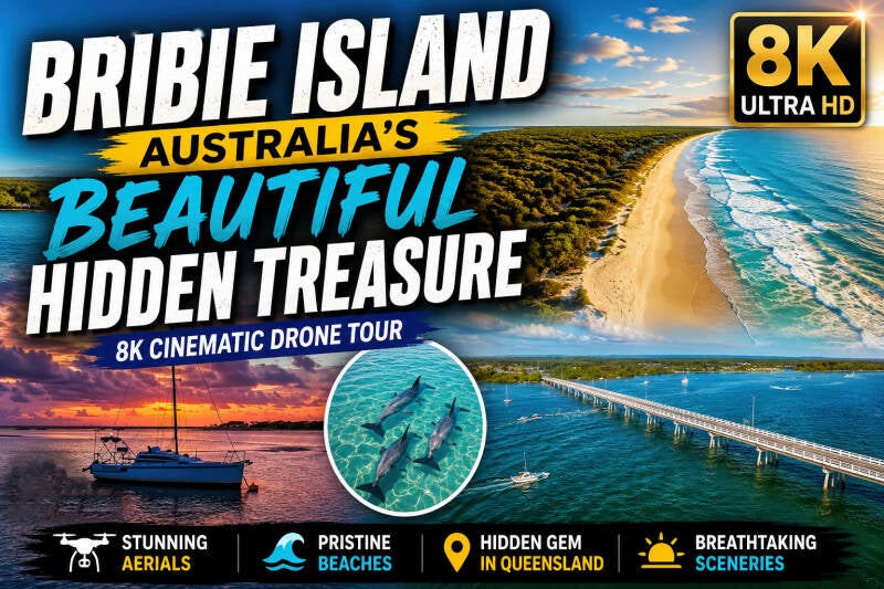
Located north of Brisbane and connected to the mainland by bridge, Bribie Island offers a relaxed coastal escape combining beaches, waterways, wetlands and national park landscapes.
From above, Bribie Island reveals a stunning contrast between the open Pacific Ocean on the eastern side and the protected waters of Pumicestone Passage on the western side.
The island's aerial landscape features:
-
sweeping beaches
-
sand dunes
-
tidal channels
-
mangrove forests
-
coastal wetlands
-
offshore views towards Moreton Island
Pumicestone Passage
One of Bribie's most distinctive features is Pumicestone Passage.
This narrow waterway separates Bribie Island from the mainland and creates a spectacular aerial composition of shifting sandbanks, blue channels and green coastal vegetation.
The passage is popular for:
-
boating
-
kayaking
-
fishing
-
bird watching
-
scenic exploration
From the air, changing tides reveal patterns and colours that are impossible to appreciate from the shoreline.
Bribie Island Photography Highlights
The best aerial photography opportunities include:
Woorim Beach
The island's famous surf beach provides dramatic views of waves, dunes and coastline.
Bongaree Foreshore
Ideal for sunset photography looking across Pumicestone Passage.
Bribie Island National Park
A combination of wilderness, beaches and coastal scenery.
Northern Bribie Island
The meeting point between ocean, sand and waterways creates some of the region's most unique aerial landscapes.
Caloundra
The Southern Gateway to the Sunshine Coast
Caloundra sits at the southern end of the Sunshine Coast and offers a collection of beautiful beaches, coastal walks, waterways and scenic headlands.
Unlike the more rugged coastline further north, Caloundra features a combination of sheltered bays, rocky headlands and family-friendly beaches.
From above, the region reveals:
-
Kings Beach
-
Bulcock Beach
-
Golden Beach
-
Moffat Beach
-
Pumicestone Passage
-
coastal parks
Kings Beach and Coastal Walks
Kings Beach is one of Caloundra's most recognised locations.
The surrounding coastline provides excellent opportunities for:
-
sunrise photography
-
ocean panoramas
-
coastal walking views
-
aerial landscape images
The Caloundra coastline walk connects several beaches and viewpoints, providing changing perspectives along the shore.
Moffat Beach
Moffat Beach offers a more relaxed coastal atmosphere with rocky shoreline, parks and excellent ocean views.
From above, the combination of headland, beach and vegetation creates beautiful natural patterns.
Golden Beach and Pumicestone Passage
Golden Beach faces the protected waters of Pumicestone Passage rather than the open ocean.
This creates:
-
calm waterways
-
shallow tidal areas
-
reflections
-
interesting aerial patterns
It is particularly impressive during sunrise and sunset.
Point Cartwright
Lighthouse, Headland and Ocean Views
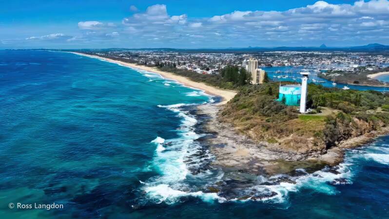
Point Cartwright is one of the Sunshine Coast's most spectacular coastal viewpoints.
Located near the mouth of the Mooloolah River, the headland provides panoramic views along the coastline and features the iconic Point Cartwright Lighthouse.
From above, Point Cartwright showcases the relationship between:
-
ocean
-
river entrance
-
beaches
-
rocky cliffs
-
coastal vegetation
Point Cartwright Photography Highlights
The area is especially suited to aerial photography.
Popular subjects include:
Point Cartwright Lighthouse
A distinctive landmark surrounded by ocean views.
Mooloolah River Entrance
The meeting point between river and ocean creates constantly changing patterns.
Mooloolaba Coastline
Aerial views reveal the curve of beaches extending along the Sunshine Coast.
Sunrise and Whale Season
During migration periods, the coastline can provide opportunities to capture whales and marine activity from elevated viewpoints.
Noosa Heads
Queensland's Iconic Coastal Destination
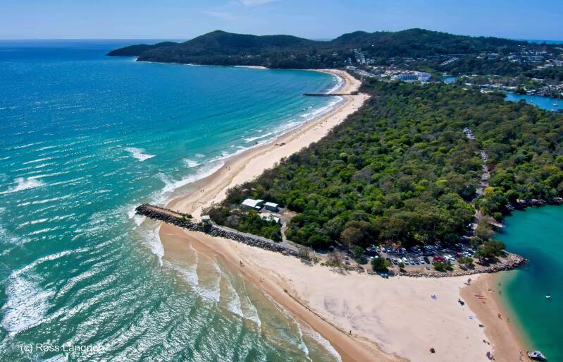
Noosa Heads represents the northern end of this coastal journey and is one of Australia's most recognised beach destinations.
The combination of Noosa National Park, Laguna Bay, Noosa River and Main Beach creates a landscape unlike anywhere else on the Sunshine Coast.
From above, Noosa reveals:
-
rainforest-covered headlands
-
pristine beaches
-
turquoise waters
-
winding waterways
-
coastal forests
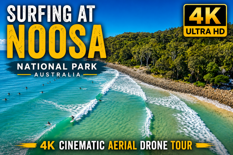
Noosa National Park
Noosa National Park protects one of Queensland's most spectacular coastal environments.
The park combines rainforest, eucalypt forest, rocky headlands and secluded beaches.
Aerial photography reveals the dramatic transition between:
-
dense green vegetation
-
rocky coastline
-
ocean waters
-
hidden bays
Noosa Main Beach
Noosa Main Beach is one of Australia's most recognisable beaches.
Its north-facing position creates a sheltered coastal environment with beautiful views across Laguna Bay.
From above, the beach forms a sweeping golden curve framed by:
-
Hastings Street
-
Noosa National Park
-
Noosa Woods
-
Laguna Bay
Noosa River
The Noosa River adds another dimension to the region.
Aerial perspectives highlight:
-
waterways
-
sandbanks
-
islands
-
mangroves
-
river channels
Changing tides continually transform the landscape, creating new photographic opportunities.
Best Time for Sunshine Coast Aerial Photography
Sunrise
The preferred time for coastal aerial photography.
Benefits include:
-
soft golden light
-
calm conditions
-
fewer visitors
-
reflections on waterways
Sunset
Excellent for:
-
rivers
-
western-facing waterways
-
golden coastline views
Winter
Often provides:
-
clear skies
-
excellent visibility
-
atmospheric mornings
Summer
Creates:
-
dramatic clouds
-
tropical colours
-
powerful storm photography
Frequently Asked Questions
What locations are included in this Sunshine Coast aerial photography guide?
This guide covers Bribie Island, Caloundra, Point Cartwright and Noosa Heads.
What is the best time to photograph the Sunshine Coast?
Sunrise and sunset generally provide the most attractive light, while winter often offers excellent visibility.
Is Bribie Island worth visiting?
Yes. Bribie Island offers beaches, waterways, wildlife, national park landscapes and a relaxed coastal atmosphere.
What is the best photography location on Bribie Island?
Popular locations include Woorim Beach, Bongaree, Pumicestone Passage and the island's northern coastal areas.
What makes Caloundra unique?
Caloundra combines beaches, sheltered waterways, coastal walks and scenic headlands.
Where can I photograph Point Cartwright?
The lighthouse, headland walking areas and views towards Mooloolaba provide excellent photography opportunities.
Why is Noosa popular with photographers?
Noosa combines beaches, rainforest, waterways and dramatic coastal scenery in one location.
Are aerial photographs available for purchase?
Yes. Selected images are available as high-resolution digital files and commercial licences.
Can businesses use these images?
Yes. Images can be licensed for tourism, marketing, editorial and commercial applications.
Can I commission aerial photography?
Custom projects may be available depending on location, requirements and approvals.
Explore More Queensland Landscapes
Continue exploring:
-
Brisbane Aerial Photography
-
Glass House Mountains
-
Scenic Rim
-
Gold Coast
-
Moreton Bay
-
Northern New South Wales
Discover Australia's landscapes from above through Oz Straya Panoramas' collection of professional aerial photography.
Commercial Aerial Photography Licensing
Sunshine Coast aerial images are available for commercial licensing.
Suitable uses include:
-
tourism marketing
-
accommodation websites
-
editorial publications
-
advertising campaigns
-
visitor guides
-
corporate displays
-
regional promotions
High-resolution aerial photography provides authentic imagery showcasing Queensland's coastline from a unique perspective.
Links to Photography Collections
This aerial photography collection was captured by Brisbane-based aerial landscape photographer Ross Langdon, specialising in South East Queensland landscapes including mountains, coastlines, waterways and national parks