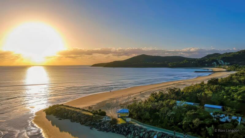
Noosa, Bribie Island & Sunshine Coast Aerial Photography | Premium Drone Images Queensland
Browse award-winning aerial drone photography of the
Noosa Heads, Bribie Island & Sunshine Coast
Ideal for tourism and commercial use.
Click on any photo below to open gallery
Digital images are available to purchase for $75 per image


Noosa, Bribie Island & Sunshine Coast Destination Guide
The Sunshine Coast is one of Queensland's most diverse coastal regions, extending from the beaches and waterways of southern coastal communities to the spectacular landscapes of Noosa and the surrounding hinterland.
From an aerial perspective, the region reveals an extraordinary combination of beaches, islands, rivers, estuaries, mountains, forests and coastal communities.
Bribie Island
Bribie Island is the only Queensland island connected to the mainland by bridge and offers a distinctive combination of surf beaches, protected waterways, coastal wilderness and native wildlife.
The Pumicestone Passage separates Bribie Island from the mainland and is particularly striking from above, with shallow waterways, sandbanks, tidal channels, mangroves and surrounding wetlands creating constantly changing patterns.
On the eastern side, Woorim Beach provides a long stretch of surf coastline, while Bribie Island National Park encompasses extensive natural areas and beaches.
Sunshine Coast
The Sunshine Coast combines more than 100 kilometres of beaches with coastal headlands, waterways, rainforest and hinterland landscapes.
Caloundra, at the southern end of the region, features beaches, coastal headlands and waterways. Further north, Mooloolaba and Maroochydore combine beaches, rivers, marinas and busy coastal communities.
The wider Sunshine Coast hinterland provides a contrasting landscape of forests, mountains, farmland and small towns, including views towards the Glass House Mountains.
Noosa
At the northern end of the Sunshine Coast, Noosa is renowned for its beaches, river, national park and distinctive coastal landscape.
Noosa Heads combines Main Beach, Hastings Street, the Noosa River and Noosa National Park. The coastal walking tracks and headlands provide spectacular views across Laguna Bay and the surrounding coastline.
Noosa also extends into a scenic hinterland of forests, farmland, villages and waterways, providing a very different perspective from the busy coastal areas.
The Region from Above
Aerial photography reveals relationships between the landscape that are difficult to appreciate from ground level.
Bribie Island's waterways and sandbanks, the long beaches of the Sunshine Coast, coastal headlands and the green hinterland form a diverse visual landscape that changes with tides, weather and light.
Early morning and late afternoon are particularly rewarding for aerial landscape photography, when lower-angle sunlight creates stronger textures, shadows and reflections.
Noosa, Bribie Island & Sunshine Coast Aerial Photography
Oz Straya Panoramas documents this diverse region through original aerial photography, including Noosa Heads, Bribie Island, Caloundra and Point Cartwright.
The collection provides high-quality aerial imagery for tourism, editorial and publishing, commercial marketing, government and environmental projects, websites and fine-art applications.
Explore the individual galleries to discover the Noosa, Bribie Island and Sunshine Coast landscapes from above.