
Coopers Gap Wind Farm Aerial Photography | Premium Drone Images Queensland
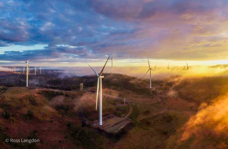
Spectacular Coopers Gap Wind Farm in the Darling Downs.
Premium stock photography for tourism, editorial & commercial use.
Digital images are available to purchase for $75 per image.
-
 Coopers Gap Wind Farm A$75.00
-
 Coopers Gap Wind Farm A$75.00
-
 Coopers Gap Wind Farm A$75.00
-
 Coopers Gap Wind Farm A$75.00
-
 Coopers Gap Wind Farm A$75.00
-
 Coopers Gap Wind Farm A$75.00
-
 Coopers Gap Wind Farm A$75.00
-
 Coopers Gap Wind Farm A$75.00
-
 Coopers Gap Wind Farm A$75.00
Coopers Gap Wind Farm - Destination Guide
Coopers Gap Wind Farm is one of Queensland's most distinctive large-scale renewable energy landscapes. Located on the Great Dividing Range in the Western Downs region, the wind farm occupies an elevated rural landscape characterised by rolling hills, open farmland and expansive views across southern Queensland.
The combination of hundreds of wind turbines and the surrounding agricultural landscape creates a striking contrast between modern renewable energy infrastructure and the traditional rural character of the region.
Coopers Gap Wind Farm
The wind farm is located near Cooranga North, north of Dalby, and forms part of Queensland's growing renewable energy landscape. Its elevated position provides extensive views across the surrounding countryside, particularly where rows of turbines follow the natural contours and ridgelines.
From an aerial perspective, the scale and layout of the wind farm become much more apparent. Individual turbines form repeating patterns across the landscape, while access roads, farmland, vegetation and changing terrain create strong geometric and leading-line compositions.
The Landscape from Above
Coopers Gap is particularly suited to aerial photography because the relationship between the turbines and surrounding countryside is difficult to appreciate fully from ground level.
From above, the landscape reveals patterns of cultivated farmland, grazing properties, roads, ridgelines and turbine arrays. Different weather and lighting conditions can also dramatically change the appearance of the region, from clear daylight and strong shadows to dramatic cloud formations and softer atmospheric conditions.
The elevated location can provide particularly impressive sunrise, sunset and storm-light photography, with the turbines silhouetted against the changing Queensland sky.
Renewable Energy & Rural Queensland
Coopers Gap represents an important visual example of the changing energy landscape of Queensland. Large-scale wind generation is now part of the broader rural environment, alongside established agricultural land and other infrastructure.
For photographers, the site provides an opportunity to document this transition and the interaction between renewable energy technology and the natural landscape.
Coopers Gap Aerial Photography
Oz Straya Panoramas documents Coopers Gap Wind Farm through original aerial photography, capturing the scale, geometry and distinctive character of the wind farm and surrounding Western Downs landscape.
The collection provides aerial perspectives of turbine arrays, rural properties, roads, ridgelines and the broader Queensland countryside.
Explore the individual Coopers Gap Wind Farm images and photography resources to see this distinctive renewable-energy landscape from above.