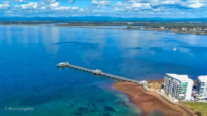
Redcliffe & Moreton Bay Region Aerial Photography Queensland
Click on any photo below to open gallery
Digital images are available to purchase for $75 per image
Stunning coastal beauty of Moreton Bay and the Redcliffe Peninsula.
Premium stock photography for tourism, editorial & commercial use.


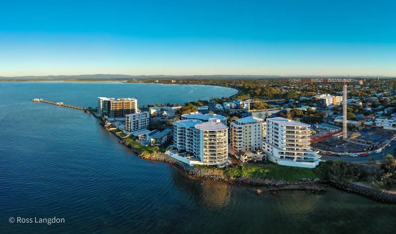
Moreton Bay & Redcliffe Peninsula Destination Guide
Islands, Beaches, Bayside Landscapes & Aerial Photography Queensland
1. Introduction
Moreton Bay and the Redcliffe Peninsula represent one of South East Queensland’s most diverse coastal landscapes, combining sheltered bays, sandy beaches, tidal wetlands, islands, marine environments and historic seaside communities.
Located north and east of Brisbane, this region provides a unique transition between urban coastal living and natural marine environments. From the calm waters of Bramble Bay and the Redcliffe Peninsula to the islands and waterways of southern Moreton Bay, the landscape offers some of Queensland’s most rewarding aerial photography opportunities.
The Oz Straya Panoramas Moreton Bay & Redcliffe Peninsula aerial photography collection captures the region from above, revealing patterns and connections that are difficult to appreciate from ground level.
Aerial imagery highlights:
- turquoise bay waters
- coastal headlands
- tidal sandbars
- island landscapes
- marinas and boat harbours
- waterfront communities
- mangrove ecosystems
- Brisbane coastal connections
The region is particularly suited to aerial photography because the interaction between land and sea creates constantly changing visual compositions.
At low tide, aerial photography reveals:
- sandbanks
- tidal channels
- shallow-water patterns
- mangrove edges
At sunrise and sunset, the bay becomes a landscape of reflections, warm coastal light and dramatic silhouettes.
Important locations within this destination include:
- Redcliffe Peninsula
- Woody Point
- Bramble Bay
- Hornibrook Highway
- Houghton Highway
- Manly Harbour
- Wellington Point
- Cleveland Point
- Victoria Point
- Coochiemudlo Island
- Moreton Bay islands
The Redcliffe Peninsula provides a particularly strong photographic identity. Its coastline, jetties and waterfront communities create distinctive compositions, while locations such as Woody Point offer views across Moreton Bay towards islands and distant mountain ranges.
For commercial users, Moreton Bay aerial imagery provides valuable visual assets for:
- tourism campaigns
- regional marketing
- coastal businesses
- publications
- environmental projects
- accommodation providers
- corporate presentations
- fine art prints
The combination of marine landscapes, islands, beaches and urban coastal environments makes Moreton Bay and the Redcliffe Peninsula one of South East Queensland’s most commercially valuable aerial photography regions.
2. History and Cultural Heritage of Moreton Bay & Redcliffe Peninsula
The history of Moreton Bay extends thousands of years before European settlement, with the region holding deep cultural importance for Traditional Custodians including the Quandamooka, Turrbal and other Aboriginal peoples connected with the bay, islands and waterways.
The marine environment provided:
- food resources
- transport routes
- cultural meeting places
- important connections between mainland and island communities
The islands, wetlands and coastal areas formed an interconnected cultural landscape where waterways were central to daily life.
European Exploration
European exploration of Moreton Bay began in the late eighteenth century, with early voyages documenting the coastline and waterways.
Redcliffe holds particular historical significance as the location of Queensland’s first European settlement in 1824 before the settlement moved to Brisbane.
The bay later became important for:
- fishing
- boating
- agriculture
- coastal recreation
- tourism
Development of Bayside Communities
Over time, communities developed along the coastline, including:
- Redcliffe
- Woody Point
- Scarborough
- Cleveland
- Wellington Point
- Victoria Point
These locations evolved from small coastal settlements into popular lifestyle destinations while maintaining strong connections with the marine environment.
Maritime Heritage
The region’s maritime history remains visible through:
- jetties
- boat harbours
- fishing locations
- shipwrecks
- coastal infrastructure
Aerial photography provides a unique way to document this relationship between people and waterways.
Modern Conservation Importance
Today, Moreton Bay remains an environmentally significant marine region containing:
- wetlands
- mangroves
- marine habitats
- island ecosystems
Aerial imagery helps communicate the importance of protecting these environments by showing their scale and connectivity.
3. Why Visit Moreton Bay & Redcliffe Peninsula?
Moreton Bay offers a completely different experience from Queensland’s mountain destinations.
Instead of rainforest peaks and waterfalls, visitors experience:
- calm bays
- island scenery
- coastal walks
- marine wildlife
- waterfront dining
- boating experiences
Coastal Beauty
The region’s greatest attraction is its relationship with the water.
Aerial views reveal:
- clear shallow bays
- beaches
- rocky points
- islands
- tidal patterns
Wildlife Experiences
Moreton Bay supports important marine ecosystems including:
- dolphins
- turtles
- migratory birds
- marine species
Photography Opportunities
The region is ideal for photography because conditions constantly change.
The same location can look completely different depending on:
- tide
- weather
- season
- time of day
Accessible Coastal Destination
Unlike remote coastal areas, Moreton Bay combines natural beauty with accessibility.
Visitors can experience:
- beaches
- islands
- walking trails
- waterfront communities
- boating
within easy reach of Brisbane.
4. Iconic Locations & Aerial Photography Opportunities
Redcliffe Peninsula
The Redcliffe Peninsula is one of the region’s strongest aerial photography subjects.
Key features:
- coastal shoreline
- Redcliffe Jetty
- beaches
- waterfront parks
- Moreton Bay views
The peninsula’s shape creates strong aerial compositions showing the relationship between land and sea.
Woody Point
Woody Point sits at the southern end of the Redcliffe Peninsula and provides excellent views across Moreton Bay.
Aerial photography opportunities include:
- Woody Point Jetty
- coastline
- boat activity
- bay reflections
- views towards islands
Sunrise and sunset are particularly valuable.
Bramble Bay & Hornibrook Highway
The connection between Brisbane and Redcliffe provides one of the region’s most recognisable aerial subjects.
The bridge alignment creates strong geometric patterns across the bay.
Photography opportunities include:
- bridge structures
- tidal flats
- boats
- coastline
- city connections
Manly Harbour
Manly Harbour provides a strong contrast between natural bay environments and boating infrastructure.
Aerial subjects include:
- marina layouts
- boats
- harbour channels
- coastline
5. Best Moreton Bay & Redcliffe Peninsula Aerial Photography Locations
Moreton Bay and the Redcliffe Peninsula offer some of the most diverse coastal aerial photography opportunities in South East Queensland. The region’s combination of islands, beaches, tidal flats, marinas, bridges and bayside communities creates constantly changing patterns that are especially powerful when viewed from above.
Unlike mountain landscapes where elevation and geology dominate, Moreton Bay photography is shaped by the interaction between:
- land
- sea
- tides
- weather
- coastal development
- marine ecosystems
This creates a dynamic photographic environment where the same location can appear completely different throughout the day.
Redcliffe Peninsula Aerial Photography
The Redcliffe Peninsula is one of the most recognisable coastal landscapes north of Brisbane.
The peninsula extends into Moreton Bay and provides a strong visual contrast between:
- urban coastline
- beaches
- marine environments
- islands in the distance
From above, aerial photography reveals the peninsula’s unique shape and its connection with surrounding waterways.
Key photographic subjects include:
- Redcliffe Jetty
- Suttons Beach
- Scarborough waterfront
- Settlement Cove Lagoon
- coastal parks
- boat activity
Sunrise aerial photography often creates excellent conditions, with soft light reflecting across Moreton Bay.
The peninsula is particularly valuable for commercial imagery because it represents a major tourism and lifestyle destination.
Woody Point Aerial Photography
Woody Point is one of the strongest aerial photography locations within the Redcliffe Peninsula region.
Located at the southern end of the peninsula, Woody Point provides expansive views across:
- Bramble Bay
- Moreton Bay
- Brisbane coastline
- distant islands
Important photographic features include:
- Woody Point Jetty
- waterfront parks
- beaches
- boats
- coastal vegetation
Aerial imagery can capture the relationship between the developed waterfront and the natural marine environment.
Sunset photography is especially effective as the western-facing location allows warm evening light across the bay.
Bramble Bay Aerial Photography
Bramble Bay is one of the most visually interesting areas of southern Moreton Bay.
The shallow waters create:
- tidal patterns
- sandbanks
- reflections
- changing coastal textures
Aerial photography reveals patterns invisible from ground level.
The bay is particularly suited to:
- abstract coastal photography
- environmental imagery
- tourism visuals
Houghton Highway & Hornibrook Highway Aerial Photography
The road connections between Brisbane and Redcliffe provide some of the most recognisable infrastructure photography opportunities in the region.
The bridges create strong geometric compositions across the bay.
Aerial images can capture:
- bridge alignment
- water reflections
- vehicle movement
- tidal landscapes
- coastline connections
These images are valuable for:
- infrastructure publications
- engineering presentations
- regional marketing
- commercial displays
The contrast between modern infrastructure and the natural marine environment creates visually powerful imagery.
6. Seasonal Photography Guide — Moreton Bay & Redcliffe Peninsula
Moreton Bay changes dramatically throughout the year, with each season creating different aerial photography opportunities.
Summer — Tropical Light, Storms & Marine Activity
Summer provides vibrant coastal conditions.
Photography opportunities include:
- intense blue water
- boating activity
- dramatic storms
- colourful sunsets
Summer storms can create powerful images with:
- dark clouds
- sunlight breaks
- reflections across the bay
Autumn — Clear Coastal Visibility
Autumn often provides excellent visibility due to lower humidity.
Benefits include:
- clearer island views
- sharp coastal details
- calmer conditions
Ideal for:
- panoramic aerial photography
- commercial tourism images
Winter — Calm Water & Sunrise Photography
Winter is one of the strongest seasons for Moreton Bay aerial photography.
Conditions often include:
- calm mornings
- soft golden light
- mist over waterways
- clear horizons
Best subjects:
- Wellington Point
- Cleveland Point
- Redcliffe Peninsula
- Manly Harbour
Spring — Wildlife & Coastal Renewal
Spring brings increased marine and bird activity.
Photography opportunities include:
- migratory birds
- greener coastal vegetation
- clearer water conditions
7. Wildlife & Natural Landscapes of Moreton Bay
Moreton Bay is one of Queensland’s most important marine environments.
The region supports diverse ecosystems including:
- seagrass beds
- mangrove forests
- wetlands
- island habitats
- coastal waterways
Marine Wildlife
The bay is home to:
- dolphins
- marine turtles
- fish species
- rays
- migratory marine animals
Aerial photography can help illustrate the relationship between wildlife habitat and coastal environments.
Birdlife
The region supports many bird species including:
- shorebirds
- pelicans
- sea eagles
- migratory species
Wetlands and tidal areas provide important feeding environments.
Coastal Ecosystems
Aerial images reveal:
- mangrove patterns
- tidal channels
- sandbanks
- shallow-water ecosystems
These perspectives are valuable for conservation and environmental education.
8. Commercial Image Licensing — Moreton Bay & Redcliffe Peninsula Aerial Photography
Professional aerial photography of Moreton Bay and the Redcliffe Peninsula provides valuable visual assets for organisations wanting to showcase one of South East Queensland’s most distinctive coastal regions.
The combination of beaches, islands, marine environments, bridges, harbours and bayside communities creates imagery suitable for a wide range of commercial applications.
Tourism Campaigns
Tourism organisations can use Moreton Bay aerial imagery to promote the region’s unique coastal identity.
Applications include:
- destination marketing campaigns
- visitor guides
- tourism websites
- social media campaigns
- advertising material
- promotional videos
Aerial images communicate the scale and beauty of the region instantly, showing visitors the relationship between mainland communities, islands and surrounding waterways.
Accommodation & Hospitality
Hotels, resorts, holiday accommodation and coastal businesses can use aerial imagery to highlight their location and surroundings.
Applications include:
- websites
- brochures
- booking platforms
- promotional material
- digital advertising
Images showing beaches, waterfront areas and nearby islands help potential visitors understand the experience of staying in the region.
Marine & Boating Industries
Moreton Bay has a strong maritime identity.
Aerial photography is valuable for:
- marinas
- boat manufacturers
- marine businesses
- boating publications
- waterfront developments
Images of:
- Manly Harbour
- boat channels
- marinas
- vessels
- coastline
provide strong visual communication.
Real Estate & Development Marketing
Coastal aerial imagery can support:
- property marketing
- development presentations
- planning documents
- community information
Aerial perspectives provide valuable context by showing:
- proximity to waterways
- transport connections
- surrounding landscapes
Environmental & Research Applications
Moreton Bay imagery can assist organisations communicating:
- marine conservation
- coastal management
- habitat protection
- environmental education
Aerial photography is particularly effective for showing:
- wetlands
- mangrove systems
- tidal environments
- island ecosystems
Publications & Media
Professional Moreton Bay images are suitable for:
- magazines
- travel articles
- documentaries
- books
- educational resources
Original local imagery provides authenticity and a stronger connection with audiences.
Fine Art Prints & Corporate Display
Moreton Bay landscapes are highly suited to premium wall art.
Popular subjects include:
- Wellington Point tidal patterns
- Cleveland Point lighthouse
- Redcliffe Peninsula coastline
- Moreton Bay islands
- sunrise and sunset reflections
Corporate offices, hotels and visitor centres often use regional landscape photography to create a connection with place.
Why Choose Local Moreton Bay Aerial Photography?
A specialist local collection provides:
✓ authentic Queensland coastal imagery
✓ knowledge of seasonal conditions
✓ location-specific perspectives
✓ original photography
✓ flexible commercial licensing options
The Moreton Bay and Redcliffe Peninsula region represents one of South East Queensland’s strongest opportunities for aerial storytelling.
9. Moreton Bay & Redcliffe Peninsula Aerial Photography — FAQs
1. Where is Moreton Bay located?
Moreton Bay is located in South East Queensland, north and east of Brisbane, extending from the Redcliffe Peninsula in the north to the southern bayside suburbs around Redlands Coast.
The bay includes numerous islands, waterways, beaches and coastal communities.
2. What is Moreton Bay famous for?
Moreton Bay is famous for:
- islands
- beaches
- marine wildlife
- boating
- fishing
- coastal scenery
- waterfront communities
It is one of Queensland’s most important marine environments.
3. Why is Moreton Bay good for aerial photography?
Moreton Bay is ideal for aerial photography because it combines:
- land and water patterns
- islands
- beaches
- tidal changes
- bridges
- marinas
- coastal communities
The landscape changes constantly with tides and weather.
4. What are the best Moreton Bay aerial photography locations?
Popular locations include:
- Redcliffe Peninsula
- Woody Point
- Bramble Bay
- Houghton Highway
- Hornibrook Highway
- Manly Harbour
- Wellington Point
- Cleveland Point
- Victoria Point
- Coochiemudlo Island
5. Why photograph Moreton Bay from above?
Aerial photography reveals features that are difficult to appreciate from ground level.
These include:
- island shapes
- tidal channels
- sandbanks
- waterways
- coastal connections
6. What makes Redcliffe Peninsula special for photography?
The Redcliffe Peninsula provides a distinctive coastal landscape with:
- beaches
- jetties
- waterfront parks
- bay views
- marine activity
Its peninsula shape creates strong aerial compositions.
7. What is Woody Point known for?
Woody Point is known for its waterfront setting, jetty, parks and views across Bramble Bay.
It is one of the most attractive locations for aerial coastal photography near Brisbane.
8. Why is Bramble Bay good for aerial images?
Bramble Bay contains shallow waters, tidal patterns and coastal landscapes that create unique aerial textures.
The bay is particularly attractive during low tide and sunrise.
9. What is the Houghton Highway known for?
The Houghton Highway provides an important connection between Brisbane and the Redcliffe Peninsula.
From above, the bridge creates strong visual patterns across the bay.
10. What makes Manly Harbour suitable for aerial photography?
Manly Harbour combines:
- marina layouts
- boats
- waterways
- coastal landscapes
The organised patterns of vessels and harbour infrastructure create visually appealing aerial compositions.
11. What is Wellington Point famous for?
Wellington Point is famous for its tidal pathway to King Island and its scenic Moreton Bay views.
It is one of Brisbane’s most photographed bayside locations.
12. Why is Cleveland Point popular for photography?
Cleveland Point is popular because of:
- lighthouse views
- coastal scenery
- sunrise opportunities
- island perspectives
13. What makes Coochiemudlo Island unique?
Coochiemudlo Island offers:
- sandy beaches
- shallow clear waters
- island vegetation
- peaceful coastal scenery
It represents the classic Moreton Bay island environment.
14. When is the best time for Moreton Bay aerial photography?
The best conditions vary:
Winter:
- calm water
- clear mornings
Summer:
- storms
- dramatic skies
Autumn:
- visibility
Spring:
- wildlife activity
15. Is sunrise better than sunset for Moreton Bay photography?
Both provide excellent opportunities.
Sunrise often offers:
- calmer conditions
- softer light
- fewer people
Sunset provides:
- warm colours
- reflections
- dramatic skies
16. What wildlife can be seen in Moreton Bay?
Moreton Bay supports a wide range of marine and coastal wildlife including:
- dolphins
- turtles
- fish species
- rays
- migratory birds
- shorebirds
The bay’s diverse habitats make it one of Queensland’s most important coastal ecosystems.
17. Are dolphins found in Moreton Bay?
Yes. Moreton Bay is well known for its resident dolphin populations.
The bay’s sheltered waters provide important habitat and feeding areas.
Aerial photography can sometimes capture marine wildlife and the broader environment that supports these species.
18. What birds live around Moreton Bay?
The region supports many bird species including:
- pelicans
- sea eagles
- shorebirds
- migratory waders
- coastal birds
Wetlands, mudflats and mangrove areas provide important feeding habitats.
19. Why are tides important for Moreton Bay aerial photography?
Tides dramatically change the appearance of the coastline.
At low tide, aerial photography can reveal:
- sandbars
- tidal channels
- exposed shorelines
- water patterns
At high tide, the same locations appear as continuous waterways.
20. What weather creates the best Moreton Bay aerial images?
Different weather creates different visual styles.
Clear conditions:
- distant island views
- sharp coastal detail
Calm mornings:
- reflections
- smooth water surfaces
Storm conditions:
- dramatic clouds
- atmospheric landscapes
Golden light:
- warm coastal colours
21. Can Moreton Bay aerial images be used commercially?
Yes. Professional Moreton Bay aerial imagery can be licensed for approved commercial uses including:
- tourism marketing
- advertising
- publications
- websites
- corporate presentations
- environmental projects
22. Can tourism operators use Moreton Bay aerial photography?
Yes. Tourism operators can use aerial imagery to promote:
- island experiences
- boating activities
- accommodation
- coastal attractions
- regional destinations
Aerial photography is particularly effective for destination marketing because it immediately communicates location and scale.
23. Can accommodation businesses use Redcliffe Peninsula aerial images?
Yes. Hotels, holiday accommodation and waterfront businesses can use imagery showing:
- beaches
- nearby attractions
- coastal views
- surrounding landscapes
This helps customers understand the experience offered by the location.
24. Are Moreton Bay images suitable for magazines?
Yes. Moreton Bay aerial photography is suitable for:
- travel magazines
- regional publications
- tourism articles
- environmental features
Original local imagery provides stronger storytelling than generic stock images.
25. Can Moreton Bay aerial footage be used in documentaries?
Yes. Aerial video is valuable for documentaries covering:
- coastal environments
- marine conservation
- Queensland destinations
- regional history
- lifestyle stories
26. Why are aerial images valuable for environmental projects?
Aerial photography helps show:
- habitat connections
- coastline changes
- marine ecosystems
- wetland areas
The broader viewpoint allows audiences to better understand environmental issues.
27. What industries use Moreton Bay aerial photography?
Industries that commonly benefit include:
- tourism
- hospitality
- marine businesses
- publishing
- real estate
- environmental organisations
- government
- education
28. Why choose local Moreton Bay aerial photography?
Local aerial photography provides:
- authentic locations
- regional knowledge
- seasonal understanding
- original perspectives
A photographer familiar with the area can capture conditions that best represent the destination.
29. Are Moreton Bay aerial images suitable for wall art?
Yes. Moreton Bay has many subjects suitable for fine art prints including:
- islands
- beaches
- tidal patterns
- bridges
- sunrise reflections
- coastal landscapes
Aerial perspectives create unique artwork compared with traditional beach photography.
30. What are popular Moreton Bay wall art subjects?
Popular subjects include:
- Wellington Point tidal pathway
- Cleveland Point lighthouse
- Redcliffe coastline
- Woody Point waterfront
- Moreton Bay islands
- Manly Harbour marina
31. How does Moreton Bay compare with Brisbane River photography?
Both offer strong but different visual styles.
Brisbane River photography features:
- city skyline
- bridges
- urban landscapes
Moreton Bay photography features:
- islands
- beaches
- marine environments
- coastal patterns
Together they represent Brisbane’s connection between city and sea.
32. How does Moreton Bay compare with Scenic Rim photography?
They provide contrasting landscapes.
Scenic Rim features:
- mountains
- rainforests
- valleys
- volcanic formations
Moreton Bay features:
- coastline
- islands
- waterways
- marine landscapes
Both are valuable South East Queensland photography destinations.
33. Is Moreton Bay one of Queensland’s best aerial photography locations?
Yes. Moreton Bay is one of Queensland’s strongest aerial photography regions because it combines:
✓ islands
✓ beaches
✓ marine ecosystems
✓ coastal communities
✓ bridges
✓ changing tides
34. Why are bridges popular aerial photography subjects?
Bridges create strong visual elements because they provide:
- lines
- patterns
- connections between locations
The Houghton Highway and Hornibrook Highway are excellent examples.
35. What makes coastal aerial photography unique?
Aerial coastal photography captures the interaction between:
- land
- water
- tides
- weather
- human activity
This creates constantly changing images.
36. Where can professional Moreton Bay aerial images be purchased?
Professional aerial images can be obtained through specialist Queensland aerial photography collections offering:
- commercial licensing
- editorial use
- tourism applications
- fine art print options
37. Why is Moreton Bay and the Redcliffe Peninsula one of Queensland’s best aerial photography destinations?
Moreton Bay and the Redcliffe Peninsula combine the features that make South East Queensland visually unique:
✓ sheltered coastal waters
✓ islands and beaches
✓ tidal landscapes
✓ marine ecosystems
✓ historic seaside communities
✓ Brisbane coastal connections
From above, the region becomes a connected coastal landscape rather than a collection of separate locations.
Professional aerial photography captures the relationship between people, waterways and nature, making Moreton Bay one of the most valuable destination photography regions in Queensland.