

South East Queensland Maps: A 2026 Aerial Guide to the Region's Best Photography Locations
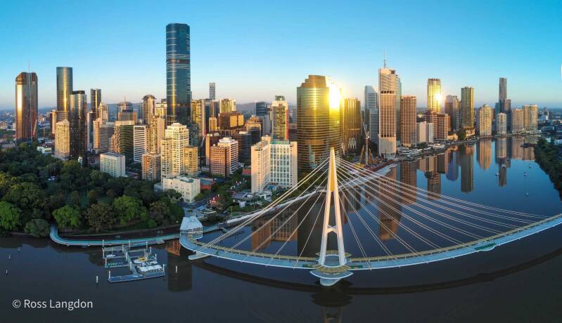
South East Queensland is a big, spread-out place, and photographing it well starts long before the rotors spin up. A good map tells you where the coastline turns, how far offshore the islands sit, which rivers cut inland and how much driving sits between two locations you want to shoot on the same morning. This guide looks at the maps that cover the region and explains how to read them like an aerial photographer, so a day out produces usable frames instead of a lot of wasted travel.
Where South East Queensland Actually Begins and Ends
The region extends from the New South Wales border in the south to Gympie in the north, and west from the coastline into the hinterland. That definition matters for planning, because it sets the outer edge of what counts as a realistic day trip from Brisbane.
South East Queensland covers 35,248 square kilometres and incorporates 11 local government areas. It takes in the state's major population centres, including Brisbane, Ipswich, the Gold Coast and the Sunshine Coast. For mapping and planning purposes, the region is commonly broken into smaller areas: Brisbane Central, Brisbane East, Brisbane North, Brisbane South, Brisbane West, Gold Coast, Ipswich, Logan and Moreton Bay, among others.
One thing to watch is that published maps do not all agree on where the region stops. A regional map of South East Queensland at 1:500,000 stretches from the New South Wales and Queensland border to past Bundaberg, covering Brisbane and the Gold Coast. Another map described as covering South East Queensland runs from the Whitsundays in the north down to the Gold Coast in the south. Neither is wrong; they simply draw the boundary more generously. Check the extent printed on any map before you assume a location is included.
Map Formats Worth Keeping in Your Kit
There is no single map that does everything. A printed regional sheet gives you the overview, an interactive government tool gives you layers, and a road map gives you the practical driving picture. Most photographers end up using all three.
Map resource Format Coverage as described by the source
Hema regional map of South East Queensland Printed regional map, 1:500,000 New South Wales and Queensland border north to past Bundaberg, covering Brisbane and the Gold Coast
Hema South East Queensland Explorer Map, Edition 2 Printed explorer map South East Queensland, from the Hema Maps explorer series
Queensland Globe Online interactive tool Queensland-wide location based information
South East Queensland highways map Online highway map Highway routes through the South East Queensland region
Gold Coast regional map of South East Queensland Online map Main roads, towns and islands, described as stretching from the Whitsundays in the north to the Gold Coast in the south.
Printed regional maps
A folded regional sheet at 1:500,000 is the fastest way to see the whole region at once. Pin it to the wall, mark the locations you want to fly, and you can spot the obvious problem straight away: two shoots on opposite sides of the region will not fit into one golden hour. Printer paper does not need a battery, either, which matters on a long day in the hinterland.
Interactive tools
The Queensland Globe provides an online interactive experience for viewing Queensland's location based information. That makes it useful for checking how a location sits against surrounding features once you have already shortlisted it on a paper map. Treat it as a verification step rather than a discovery tool, and always confirm current details against the official source.
Highway and road maps
Highway maps are the ones that keep a shoot day realistic. They show you the main routes, the towns along the way and how the coastline and islands are arranged, which is exactly the information you need when you are deciding whether a second location is worth the drive. A road map also tells you where the road ends, and that often decides where the drone goes up.
Reading the Region the Way a Drone Pilot Does
Once you have a map in front of you, the job shifts from finding places to judging whether they will work from the air. A few habits make that much easier.
Brisbane and the river
Brisbane sits inside the Brisbane Central, North, South, East and West breakdown used in regional mapping. The river is the feature that organises everything else, so tracing it on a map before you leave home shows you where the bends, bridges and city reaches sit relative to each other. Work out your angle on paper first, then arrive with a plan rather than circling.
Moreton Bay and Redcliffe
The Moreton Bay area is one of the named regional divisions, and the bay is where a map earns its keep. Islands, channels and the mainland edge all read very differently from the air than from a road atlas, so use a map that shows islands clearly and check how far offshore your subject actually sits.
The Sunshine Coast and Noosa
The Sunshine Coast is one of the region's major population centres, and it is also where the coastline changes character. A map lets you pick a stretch of coast that runs in the direction you want the light to travel, so the beach reads as a line rather than a flat grey band.
Glass House Mountains
Groups of peaks are a mapping problem as much as a photography one. On a regional sheet you can see how the peaks sit in relation to one another and to the surrounding road network, which helps you choose a launch point that puts more than one summit in frame.
The Scenic Rim
Inland locations depend on elevation and access, both of which show up on a decent topographic or regional map. Check where the roads actually go before committing to a pre-dawn departure, because a promising ridge on a small-scale map can be a long way from anywhere you can legally stop.
The Gold Coast and the Tweed Coast
The Gold Coast is one of the region's major centres and it sits right against the New South Wales border, which is exactly where the boundary of South East Queensland falls. The Tweed Coast continues south from there. A map that spans the border is the only way to plan a morning that moves between the two without doubling back.
Access, Weather and Airspace Belong on the Map Too
A map shows you where the landscape is. It cannot tell you whether you are allowed to fly there, so build a second layer into your planning. Requirements can vary depending on whether you are near a major airport, over public land, or on private property, and land managers may apply their own conditions on top of that. Confirm current rules with the relevant aviation authority and check with the land manager before you travel. Weather is the other variable, and it changes fast along this coastline, so check the forecast on the day rather than the week before.
Building Your Own Shot List Map
Start with a broad regional map at around 1:500,000 and mark every location you would like to photograph, without editing yourself yet.
Group the marks by sub-region using the standard breakdown: Brisbane, Gold Coast, Ipswich, Logan, Moreton Bay and the rest.
Draw a realistic travel loop around each group and delete anything that does not fit the available light.
Check each surviving location on an interactive tool such as the Queensland Globe to confirm how it sits against surrounding features.
Note the access and permission questions against each pin, and resolve them before the shoot rather than on arrival.
Keep the finished list somewhere you can re-use it, because South East Queensland rewards repeat visits in different conditions.
The reason this matters for aerial work is simple. From 120 metres up you cannot reposition a mountain, and you cannot move a river. The only lever you have is where you launch from and when. A map is how you get that decision right before you leave the driveway.
Frequently Asked Questions
Which areas does South East Queensland cover?
The region runs from the New South Wales border in the south to Gympie in the north, and west from the coastline into the hinterland. It covers 35,248 square kilometres across 11 local government areas and includes the state's major population centres of Brisbane, Ipswich, the Gold Coast and the Sunshine Coast, along with Logan, Moreton Bay and the Brisbane sub-regions.
Do I still need a paper map if I have an interactive tool?
They do different jobs. A printed regional map gives you the whole picture at once, which suits planning and marking up. The Queensland Globe provides an online interactive experience for viewing Queensland's location based information, which is better for checking a single location in detail. Most photographers use the paper map to shortlist and the interactive tool to confirm.
Which map is best for planning an aerial photography trip?
A regional map at around 1:500,000 is the most practical starting point, because it covers the border to past Bundaberg and takes in Brisbane and the Gold Coast in one view. From there, check individual locations on an interactive tool and confirm access and permission details before you commit to an early start.
Where can I verify map and location details?
Always confirm details against the official source rather than a third party summary, since map extents, road conditions and access arrangements change. Government mapping tools and the map publisher's own product information are the most reliable references. If a map's coverage is unclear, check the extent printed on it before you plan a trip around it.
Good maps do not make a photograph, but they stop you wasting the best light of the day in the wrong place. Pick a regional sheet, add an interactive tool for confirmation, layer in access and weather checks, and keep the resulting list somewhere you can build on. South East Queensland is large enough that a mapped plan will keep paying off across many return trips, from the Brisbane River out to the border and back up the coast.