

Redcliffe, Redland & Moreton Bay Region
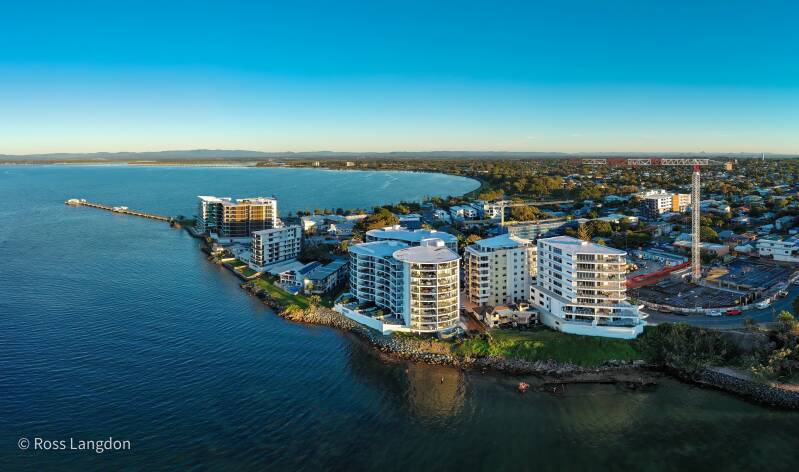
This page showcases a stunning collection of aerial photography capturing the coastal beauty of Moreton Bay, the Redland region, and the Redcliffe Peninsula in Southeast Queensland. Through high-resolution drone imagery, visitors can explore pristine beaches, sheltered bays, coastal headlands, islands, estuaries, marinas, and waterfront communities from a unique aerial perspective. The gallery features iconic locations including Cleveland Point, Wellington Point, Coochiemudlo Island, Jacobs Well, Bramble Bay, Woody Point, and other scenic coastal destinations that define the character of the Moreton Bay region.
Part of the Oz Straya Panoramas portfolio, the collection highlights the region's diverse marine environments, tidal flats, coastal wetlands, and picturesque shorelines. Captured during optimal lighting conditions, the photographs reveal the intricate relationship between land and sea while showcasing the natural beauty and recreational appeal of one of Queensland's most cherished coastal regions. These professionally produced images are available for licensing, tourism marketing, editorial publications, commercial projects, website content, and fine-art displays.
Click on any photo below to open gallery
Digital images are available to purchase for $75 per image
-
 Jacobs Well Gallery A$75.00
 -
 Cabbage Tree Point Gallery A$75.00


🌊 Moreton Bay & Redcliffe Peninsula – Destination Guide
Explore the scenic coastlines, islands, and waterways of Moreton Bay and the Redcliffe Peninsula, a region rich in history, marine life, and recreational opportunities.
About Moreton Bay & Redcliffe Peninsula
Located just north of Brisbane, Moreton Bay encompasses a large marine park with islands, wetlands, sandy beaches, and estuaries. The Redcliffe Peninsula, on the bay’s southern edge, is known for its sandy shores, jetty, and historic seaside townships.
Highlights include:
- Clear waters, islands, and sandbars
- Coastal walking tracks and lookouts
- Diverse wildlife, including dolphins, turtles, and migratory birds
- Panoramic views for aerial photography
The region is ideal for both recreational and professional photography, showcasing the meeting of land, sea, and sky.
Local History
Indigenous Heritage
The Moreton Bay area is the traditional land of the Gubbi Gubbi, Turrbal, and Quandamooka peoples. The waterways, islands, and coastline were used for food gathering, navigation, and cultural ceremonies. Many locations remain culturally significant today.
European Settlement
- Redcliffe is the site of Queensland’s first European settlement in 1824.
- Initially established as a penal colony and port, Redcliffe grew into a recreational seaside town by the 19th century.
- Moreton Bay has historically supported shipping, fishing, and maritime industries.
Modern Significance
Today, Moreton Bay and the Redcliffe Peninsula balance tourism, conservation, and recreation. The Moreton Bay Marine Park protects sensitive ecosystems, while walking tracks, boat ramps, and lookouts invite visitors to explore the region responsibly.
Visitor Information
Best Times to Visit:
- Autumn & Winter (March–August): Cooler, drier weather with clear skies
- Spring & Summer (September–February): Warm water and lush surroundings; thunderstorms possible
Activities:
- Island-hopping and boating tours to North Stradbroke, Moreton, and Bribie Islands
- Kayaking and paddleboarding in sheltered bays
- Dolphin and whale watching
- Beach recreation along Redcliffe Peninsula
- Coastal walking and cycling trails
- Aerial photography and landscape observation
Getting There:
- 35–50 km from Brisbane CBD, accessible by car or public transport
- Key visitor centres provide maps, boat hire information, and wildlife advice
- Ferry and tour operators offer access to islands and marine experiences
Image Licensing Information
Standard Editorial License:
- Blogs, news, educational content, and non-commercial use
Commercial License:
- Tourism promotion, brochures, marketing, websites, advertising campaigns
Fine Art & Display License:
- Office interiors, galleries, visitor centers, hotels, and residential wall art
Restrictions:
- Images cannot be resold as standalone digital files
- Redistribution through stock platforms is prohibited
- Certain commercial or sensitive locations may require additional permission
🌊 Moreton Bay, Redlands & Redcliffe Peninsula Aerial Photography Guide – 50 FAQs
🌅 General Overview
1. Where is Moreton Bay located?
Moreton Bay is a coastal region in South East Queensland, Australia, near Brisbane.
2. What areas are included in Moreton Bay and Redlands?
It includes Redcliffe Peninsula, Redland City, bayside suburbs, and nearby islands.
3. Why is this region popular for aerial photography?
Because it combines islands, coastal sandbars, bays, and city skylines in one region.
4. What makes Redcliffe Peninsula unique from above?
Its long shoreline, jetties, and coastal suburbs create strong linear compositions.
5. Is Moreton Bay a natural or developed area?
It is a mix of natural bay environments and coastal urban development.
📸 Aerial Photography Appeal
6. What is the best aerial feature of Moreton Bay?
The contrast between turquoise water, islands, and mainland coastline.
7. Why is Redland City good for drone photography?
It offers mangroves, bays, islands, and rural coastal landscapes.
8. What makes Redcliffe visually interesting?
Its jetties, beaches, and long peninsula shape.
9. Can you capture islands from Redcliffe?
Yes, Moreton Island is often visible from aerial viewpoints.
10. What is the most iconic aerial composition?
Wide shots showing bay water patterns and island silhouettes.
🌤️ Best Time for Photography
11. What is the best time for aerial photography in Moreton Bay?
Sunrise and sunset for soft light and reflective water.
12. Why is sunrise ideal?
Calm winds create mirror-like bay conditions.
13. Is sunset good for Redcliffe photography?
Yes, especially for warm golden reflections over the water.
14. Are cloudy days useful?
Yes, they reduce glare and enhance mood.
15. Does wind affect bay photography?
Yes, it impacts water texture and drone stability.
🚁 Drone Photography Tips
16. Is drone flying allowed in Moreton Bay?
Yes, but CASA regulations and local restrictions apply.
17. What altitude is best for bay photography?
Typically 60–120 metres depending on composition.
18. Should you fly over water or land?
Both are useful, but avoid flying over people or crowded beaches.
19. What camera settings work best?
Low ISO, fast shutter, and RAW format for dynamic range.
20. Are ND filters useful here?
Yes, they help balance bright water reflections.
🏝️ Key Locations
21. What are key locations in Redcliffe Peninsula?
Scarborough, Woody Point, Margate, Clontarf, and Redcliffe Jetty.
22. What is Redcliffe Jetty known for?
It is one of the most iconic coastal structures in the region.
23. What is Scarborough famous for?
Its marina, waterfront views, and calm bay waters.
24. What is Woody Point known for?
Long pier views and sunset compositions.
25. What islands are visible from Redcliffe?
Moreton Island is often visible across the bay.
🌿 Landscape & Environment
26. What type of environment is Moreton Bay?
A shallow coastal bay with islands, sandbanks, and mangroves.
27. What makes Redlands unique?
It combines rural land, wetlands, and coastal suburbs.
28. Are mangroves important in compositions?
Yes, they create strong texture patterns from above.
29. Are sandbars visible in the bay?
Yes, especially at low tide.
30. What water features stand out most?
Tidal patterns, estuaries, and island shorelines.
🌅 Lighting & Conditions
31. What weather is best for aerial photography?
Clear or lightly cloudy conditions with minimal wind.
32. Does tide affect photography?
Yes, low tide reveals sandbanks and tidal patterns.
33. Is fog common in the region?
Occasionally in early mornings during cooler months.
34. Are sunsets reliable in Redcliffe?
Yes, especially over western-facing bay views.
35. Is midday good for drone photography?
Only for bright water clarity shots.
📍 Access & Viewing
36. Is Redcliffe easy to access for photographers?
Yes, it is well-connected and close to Brisbane.
37. Are there public lookouts?
Yes, multiple coastal parks and jetties.
38. Can you walk along the entire peninsula?
Large sections are walkable via coastal paths.
39. Is the area busy?
Yes, especially on weekends and holidays.
40. Best time to avoid crowds?
Early morning weekdays.
📷 Commercial & Stock Photography
41. Are Moreton Bay aerial images in demand?
Yes, especially for tourism and coastal branding.
42. Can Redcliffe photos be licensed commercially?
Yes, depending on usage rights.
43. What industries use these images?
Tourism, real estate, advertising, and local government.
44. Are aerial bay images good for marketing?
Yes, they are widely used in travel promotions.
45. Why is this region valuable for stock photography?
It combines urban coastlines with natural island landscapes.
🚁 Safety & Regulations
46. Are drones restricted in Moreton Bay?
Yes, some areas have restricted airspace and population limits.
47. What are CASA drone rules in Australia?
They regulate altitude, distance from people, and no-fly zones.
48. Can you fly near beaches in Redcliffe?
Only if you maintain safe distance from crowds.
49. What is the biggest drone risk here?
Flying over populated coastal areas.
50. What is the most common mistake photographers make?
Ignoring tide conditions and flying too close to people or infrastructure.