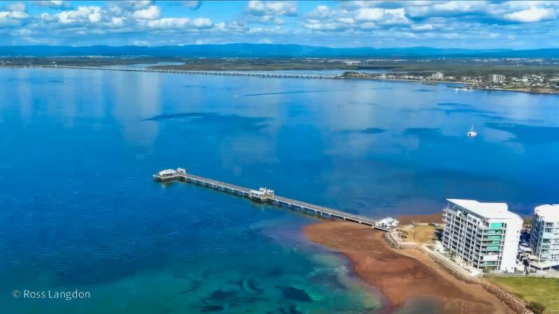
Redcliffe & Moreton Bay Region Aerial Photography Queensland
Click on any photo below to open gallery
Digital images are available to purchase for $75 per image
Stunning coastal beauty of Moreton Bay and the Redcliffe Peninsula.
Premium stock photography for tourism, editorial & commercial use.


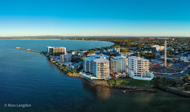
Moreton Bay & Redcliffe Peninsula Destination Guide
The Moreton Bay and Redcliffe Peninsula region offers one of South East Queensland's most diverse coastal landscapes, combining beaches, sheltered bays, tidal wetlands, islands, marinas and historic seaside communities.
Located north and east of Brisbane, the region provides a transition between Brisbane's urban environment and the natural marine landscapes of Moreton Bay. From the Redcliffe Peninsula and Woody Point to Bramble Bay and the surrounding waterways, the area offers exceptional opportunities for coastal photography.
Redcliffe Peninsula
The Redcliffe Peninsula extends into Moreton Bay and is one of the region's most recognisable coastal landscapes.
The peninsula combines beaches, waterfront parks, jetties, marine activity and panoramic views across Moreton Bay. Redcliffe Jetty, Suttons Beach and Scarborough are among the area's notable coastal locations.
From above, the peninsula's shape and surrounding waterways create a strong relationship between urban development, beaches and the bay.
Woody Point
Woody Point, at the southern end of the Redcliffe Peninsula, provides expansive views across Bramble Bay and Moreton Bay.
The waterfront, jetty, beaches and surrounding marine environment are particularly attractive from above, especially during early morning and late afternoon when changing light creates reflections across the water.
Bramble Bay & Hornibrook Highway
Bramble Bay provides a distinctive combination of shallow coastal waters, tidal patterns, sandbanks and shoreline.
The Hornibrook Highway and Houghton Highway connections create strong geometric features across the bay and provide an interesting contrast between modern infrastructure and the surrounding marine environment.
Low tide can reveal intricate patterns of sandbanks, channels and shallow water that are difficult to appreciate from ground level.
Manly Harbour
Further south, Manly Harbour provides a different perspective on Moreton Bay, combining marina infrastructure, boats, waterways and coastal landscapes.
The harbour's network of channels and vessels creates particularly interesting aerial compositions and demonstrates the strong maritime character of Brisbane's bayside suburbs.
Moreton Bay from Above
Aerial photography reveals the scale and connectivity of the region. From above, beaches, islands, tidal flats, mangroves, waterways, marinas and coastal communities become part of one interconnected landscape.
The appearance of Moreton Bay changes constantly with tide, weather and light. Sunrise can produce calm water and soft reflections, while sunset and changing weather can create dramatic coastal conditions.
Moreton Bay Aerial Photography
Oz Straya Panoramas documents the Moreton Bay and Redcliffe Peninsula region through original aerial photography, including Redcliffe, Woody Point, Bramble Bay, Hornibrook Highway and Manly Harbour.
The imagery is available for tourism, editorial and publishing, commercial marketing, environmental and educational projects, websites and fine-art applications.
Explore the individual location galleries to discover the Moreton Bay and Redcliffe Peninsula landscapes from above.