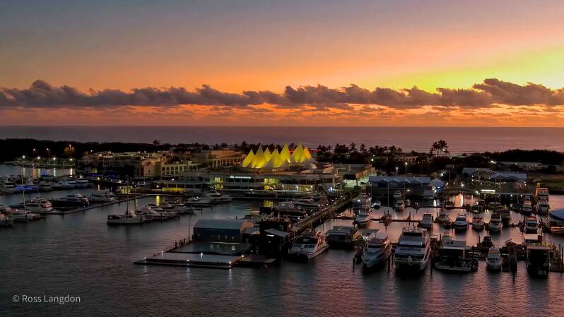
Southport Marina, Gold Coast Seaway & Gold Coast Aerial Photography | Premium Drone Images Queensland
Aerial photography of the Gold Coast — Surfers Paradise, Southport Marina & the Seaway captured by drone. Stock images and video for licensing or wall art.
Click on any photo below to open gallery
Digital images are available to purchase for $75 per image
-
 Surfers Paradise Gallery A$50.00
 -
 Southport Marina Gallery A$75.00


Gold Coast Destination Guide
The Gold Coast is one of Australia's most recognisable coastal destinations, combining long surf beaches, a dramatic skyline, extensive waterways, islands, marinas and the rainforest-covered mountains of the Gold Coast Hinterland.
Located in South East Queensland, the region extends from the coastal city and Surfers Paradise south towards the Queensland–New South Wales border, with the Pacific Ocean, rivers and hinterland forming a diverse landscape.
Surfers Paradise & Main Beach
Surfers Paradise is the iconic centre of the Gold Coast, recognised for its long sandy beach, high-rise skyline and vibrant coastal atmosphere.
From above, the contrast between the Pacific Ocean, sweeping beach and dense city skyline creates one of Queensland's most recognisable aerial landscapes.
Nearby Main Beach and The Spit form a narrow coastal landscape separating the Pacific Ocean from the Gold Coast Broadwater and its waterways.
Southport & the Broadwater
Southport is the commercial and waterfront centre of the northern Gold Coast, positioned beside the sheltered waters of the Gold Coast Broadwater.
The Broadwater contains islands, sandbanks, tidal channels, marinas and wetlands. From above, these features reveal constantly changing patterns created by tides, currents and weather.
Gold Coast Seaway
The Gold Coast Seaway connects the Broadwater with the Pacific Ocean at the northern end of The Spit.
The meeting of ocean, tidal waterways, rock walls and navigation channels creates a particularly distinctive aerial landscape, with the surrounding coastline and marine environment clearly visible from above.
Gold Coast Waterways
Beyond the beaches and skyline, the Gold Coast contains an extensive network of rivers, canals, estuaries and coastal waterways.
The Nerang River, Coomera River and Broadwater connect the urban coastline with wetlands, islands and inland catchments. These waterways provide strong aerial compositions through their curves, reflections, sandbanks and changing tidal patterns.
Gold Coast Hinterland
Behind the coastal city, the Gold Coast Hinterland rises into a landscape of mountains, rainforest, waterfalls and valleys.
Springbrook National Park, Lamington National Park and Beechmont provide a dramatic contrast to the coastal skyline and are covered separately within the Oz Straya Panoramas collection.
The Gold Coast from Above
Aerial photography reveals the relationship between the Gold Coast's ocean, beaches, skyline, waterways, islands and hinterland.
Sunrise and sunset can produce particularly striking light across the coastline and waterways, while low tide reveals sandbanks, channels and shallow-water patterns. Clear winter conditions can also provide excellent visibility towards the hinterland.
Gold Coast Aerial Photography
Oz Straya Panoramas documents the Gold Coast through original aerial photography, including Surfers Paradise, Southport, the Gold Coast Broadwater, Gold Coast Seaway, Main Beach, The Spit and surrounding waterways.
The imagery is available for tourism, editorial and publishing, commercial marketing, environmental and educational projects, websites and fine-art applications.
Explore the individual galleries to discover the Gold Coast's beaches, skyline and waterways from above.