Soaring with Giants: A drone's eye view of the Glasshouse Mountains
by Ross Langdon
Discover the ancient beauty of the Glass House Mountains from the above
In this blog post, we will explore some of the most captivating drone captures of the Glasshouse Mountains, including Mount Beerwah, Mount Coonowrin, Mount Tibrogargan, Mount Ngungun, and Mount Tibberoowuccum.
Join us as we explore aerial perspectives through stunning drone photography & videography.
There’s a perspective of the Glass House Mountains that, for millennia, was reserved only for eagles.
The sheer scale, the hidden contours, and the profound connection between these ancient volcanic plugs remained a secret of the sky.
That is, until now.
With the rise of drone technology, we can finally take flight and witness these Queensland icons as they were always meant to be seen.
The All-Father: Mount Beerwah from Above
Mount Beerwah is the highest peak in the Glasshouse Mountains, standing at 556 meters above sea level.
The mountain is known for its challenging climbing routes and offers stunning panoramic views from the summit.
As the tallest of the range, Mount Beerwah commands respect from the ground.
Drone capture of Mount Beerwah often shows its majestic height and the lush green forest surrounding it.
But from the air, its character transforms. The drone reveals its vast, sweeping slopes, a grand, weathered shield of rock and scrub. ·
The Grand Scale:
From a top-down perspective, you can truly appreciate Beerwah's immense footprint. The drone’s lens captures the intricate patterns of its rocky face and the deep green vegetation clinging to its sides. ·
The Summit Vista:
While the climb is challenging, the drone offers a virtual summit.
Hovering at the peak, the camera can pan out to show Beerwah’s commanding view over its smaller siblings, a true patriarch surveying his family.
The Sentinel: Mount Tibrogargan's Silent Watch
Mount Tibrogargan is one of the most identifiable peaks in the Glasshouse Mountains due to its resemblance to a face staring east towards the ocean.
Tibrogargan is perhaps the most recognizable silhouette, a patient sentinel gazing out towards the coast.
From the ground, he appears as a solid, impenetrable mass. From the air, his story becomes more complex.
Drone capture of Mount Tibrogargan often focus on this unique feature, showcasing the mountain's silhouette against the sky.
Images & footage reveals the mountain's grandeur and the surrounding natural environment, which includes a mix of forested areas and open plains.
Revealing the Form:
A drone orbit around Tibrogargan unveils its unique, hunchbacked profile from every angle.
You see the dramatic, near-vertical cliffs that make it a challenging climb and the surprisingly complex geology of its summit.
The Coastal Gaze:
Flying a drone out from Tibrogargan’s face, we can literally follow his legendary gaze across the plains to the ocean, visually telling the Aboriginal Dreamtime story of why he turns his back on his son, Coonowrin.
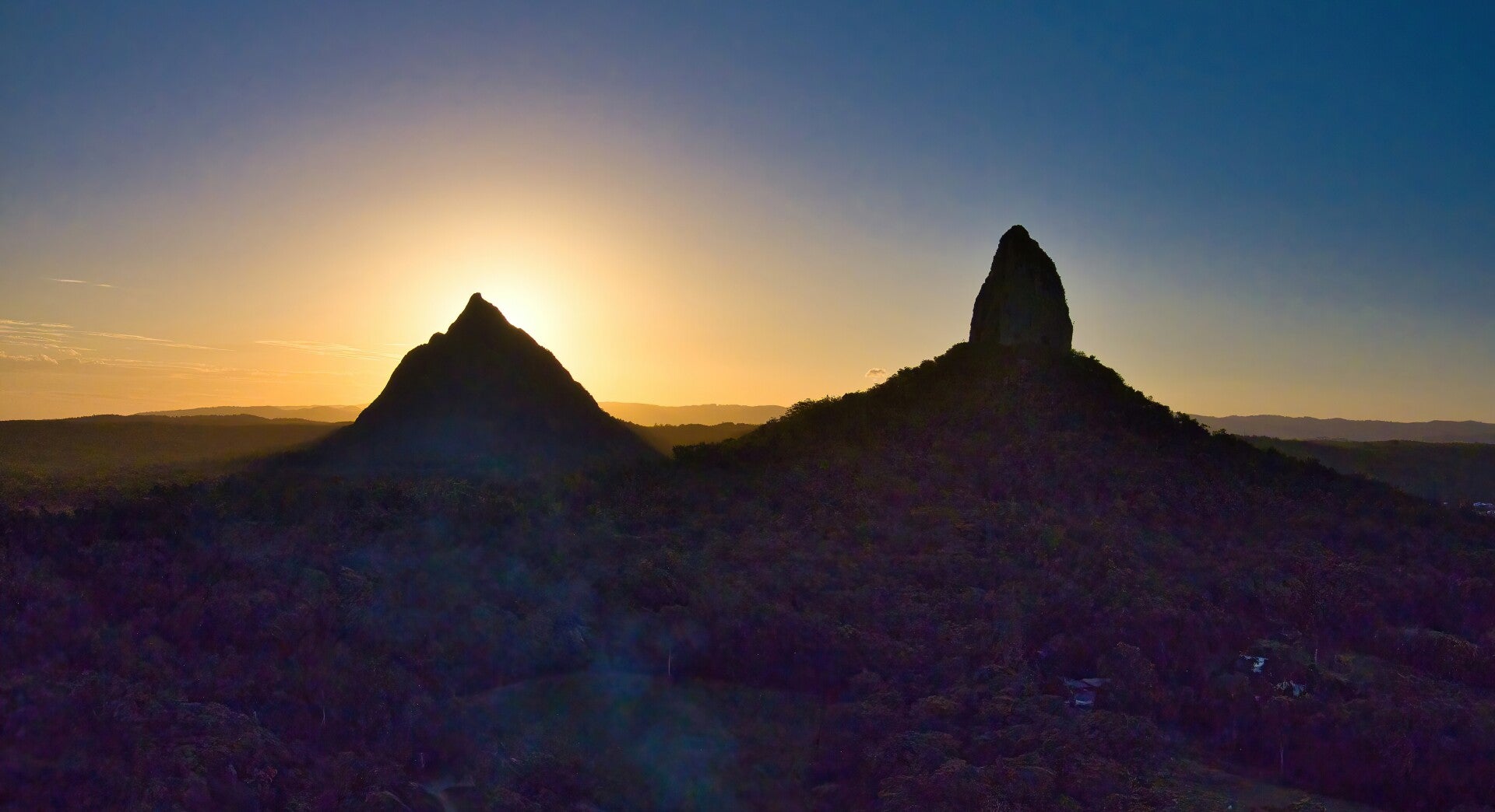
The Prodigal Son: The Dramatic Peak of Mount Coonowrin
Mount Coonowrin, also known as Crookneck, is easily distinguished by its unique rocky formation at the top.
Coonowrin is the most dramatic and fragile of the trio.
Its sharp, jagged peak is a striking subject from any angle, but the aerial view is unparalleled.
The drone can get close to details inaccessible to hikers.
It highlights the incredible, almost precarious, spire-like formation at its summit, a testament to millions of years of erosion.
Drone capture of this mountain often highlights its distinctive shape against the backdrop of the Sunshine Coast Hinterland.
The aerial views reveal the mountain's rugged terrain and the dense forest that surrounds it, creating a striking contrast between the natural beauty of the landscape and the mountain's imposing presence.
The climber's favorite: Mount Ngungun
Mount Ngungun is another prominent peak in the Glasshouse Mountains.
While specific drone capture of Mount Ngungun may not be as widely available as that of Mount Beerwah or Mount Coonowrin, it is still a significant part of the mountain range. Its lower elevation compared to other peaks makes it easily accessible for hikers and offers a different perspective on the Glasshouse Mountains.
The Sentinel, Mount Tibberoowuccum
Mount Tibberoowuccum is another notable peak in the Glasshouse Mountains.
Drone capture of this mountain shows its distinctive shape and the surrounding landscape, highlighting the diverse geological features of the area.
The aerial views provide a sense of the mountain's scale and its place within the larger Glasshouse Mountains range.
The Art of Aerial Capture:
More Than Just a Flight Capturing these landscapes isn't just about launching a drone, it’s about: Chasing the Light.
The golden hours of sunrise and sunset paint the rhyolite and trachyte rock faces in warm, ethereal glows, adding a layer of magic to the scene.
Playing with Perspective:
Using the drone’s ability to change altitude and angle, we can create leading lines with ridges, capture the perfect symmetry of a mountain's shadow at dawn, or reveal the hidden, tiny forests nestled in its gullies.
Respecting the Giants:
Flying responsibly is paramount. This means maintaining a safe distance from wildlife, adhering to CASA regulations, and preserving the natural quiet and sanctity of this sacred place.
I ensured my flights were conducted in accordance with *Queensland Parks and Wildlife Service (QPWS)* & *CASA* regulations.
Avoided disturbing wildlife or other visitors.
Stayed within visual line of sight and below 120 meters AGL.
Respected designated no-fly zones and cultural sites.
Always check local regulations and obtain permits if required.
Leave no trace—both on the ground and in the sky.
Drone captures don't diminish the grandeur of the Glass House Mountains; it amplifies it.
It allows us to connect with these ancient landforms on a deeper level, understanding their forms, their relationships, and their place in the landscape in a way that was once impossible.
They are more than just mountains; they are a family, a story, and a timeless landmark.
And from the air, we are privileged to read that story as a whole.
Conclusion
These drone captures of the Glasshouse Mountains offer a unique and breathtaking perspective on these natural wonders.
The imagery & video footage not only showcases the beauty of the mountains but also highlights their geological significance and the diverse landscapes that make up the region.
Whether you are a drone enthusiast, a nature lover or simply someone who appreciates stunning aerial views, the Glasshouse Mountains are sure to leave a lasting impression.
Ross Langdon, Drone Photographer/Videographer & Nature Enthusiast
Except as permitted by the copyright law applicable to you, you may not reproduce or communicate any of the content on this website, including files downloadable from this website, without the permission of the copyright owner.